
Experiencing one of the driest places on the planet is part of the attraction of the Atacama Desert of Chile, however, the desert is not without its lakes and oases or completely uninhabitable. San Pedro de Atacama is one of those oases where people have settled and carved what green they can out of the dry rocky soil. Several other small towns surround other oases in the region.
In the same way these human settlements have popped up, many birds and mammals have discovered the wondrous lakes among the mountainous landscape and made them home. In another study of contrasts, we’ll switch from the moon-like areas completely void of life and visit regions of the Atacama where the available water creates some truly unique landscapes in the high mountain desert.
Some of the most popular attractions in the area around San Pedro are the area’s lagunas and salars in the nearby Los Flamingos National Park. Lagunas, obviously, are natural freshwater lakes. Salars are the salt flats formed by receding salt lakes similar to what you’ll find at the (once) Great Salt Lakes in Utah in the United States. With a rental car and a reservation to the park, you can spend the morning wandering around the mesmerising Salar de Aguas Calientes and then visit Lagunas Miscanti and Miñiques in the afternoon. We followed our day at the moon with a trip back to Earth on 26-May and discovered a completely different landscape.
The Long Drive
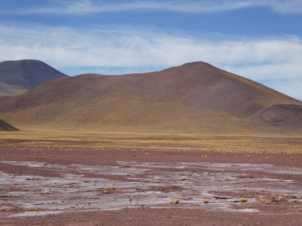
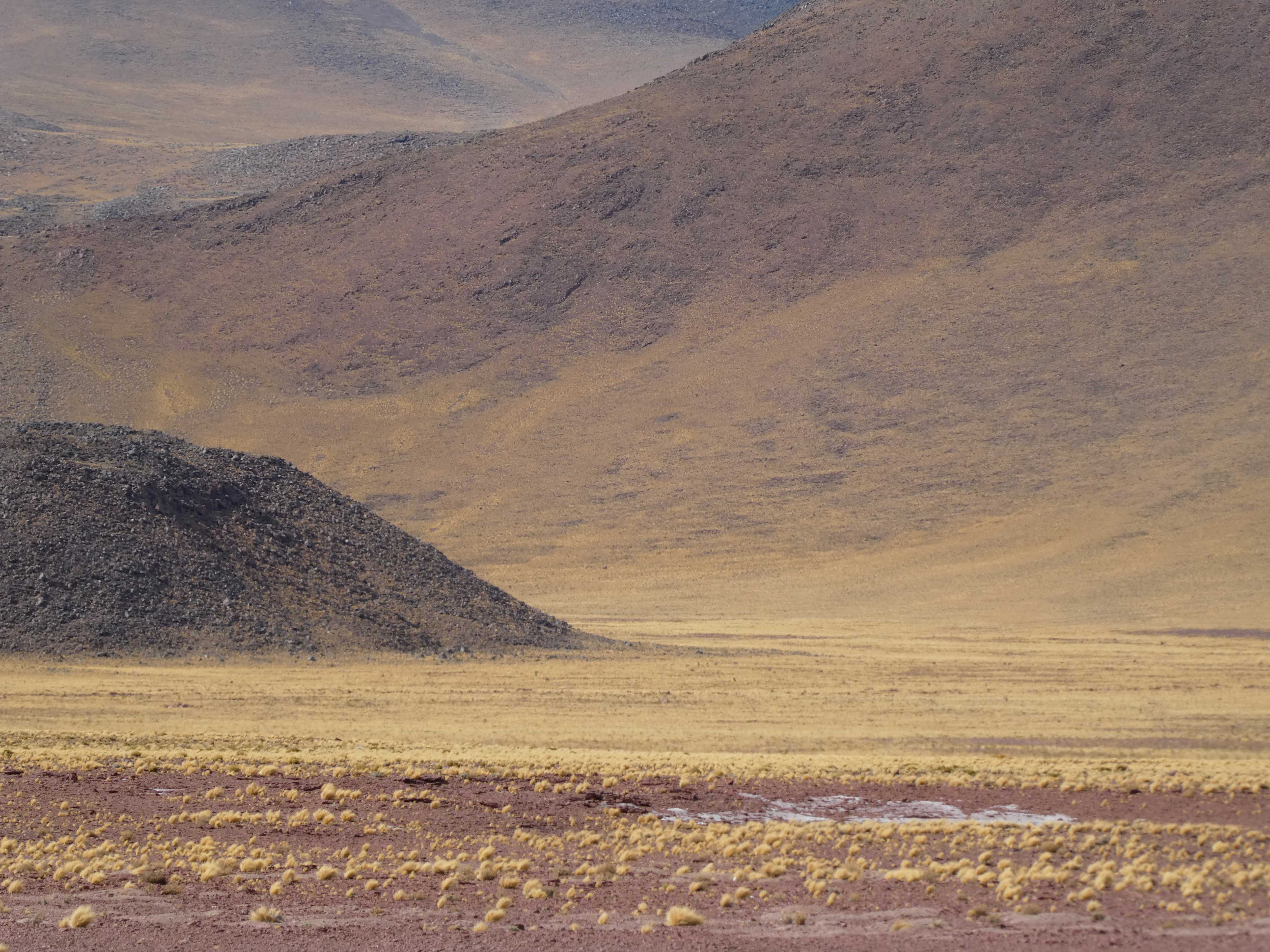
The drive from San Pedro to Salar de Aguas Calientes is about two hours with an elevation change from 7,900 feet to just over 14,000 feet. The plains as you leave San Pedro are dotted with tufts of yellow grasses that provide a spectacular color contrast as they reflect the unfiltered sunlight.

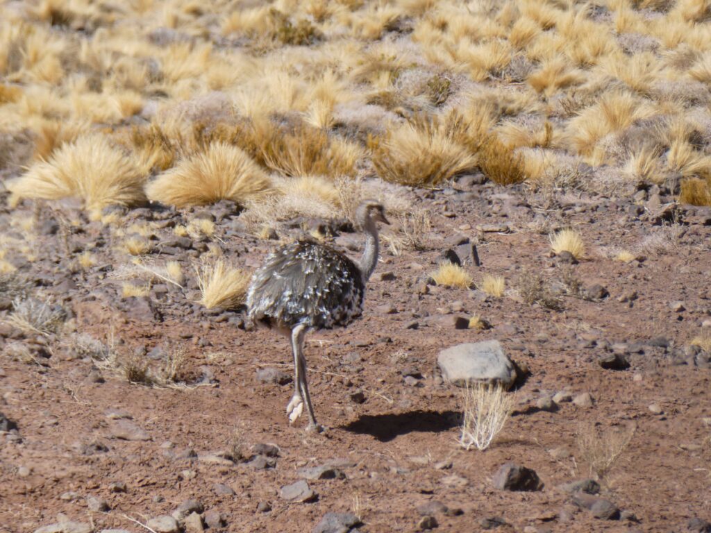
As we headed into the hillier areas, we started to find the wildlife living in and among the grasses. We were actually surprised to find a rather tame rhea that didn’t instantly bolt away from the car as the ones we encountered in Argentina did. The rhea was actually the first large animals we had seen in our time in Chile.
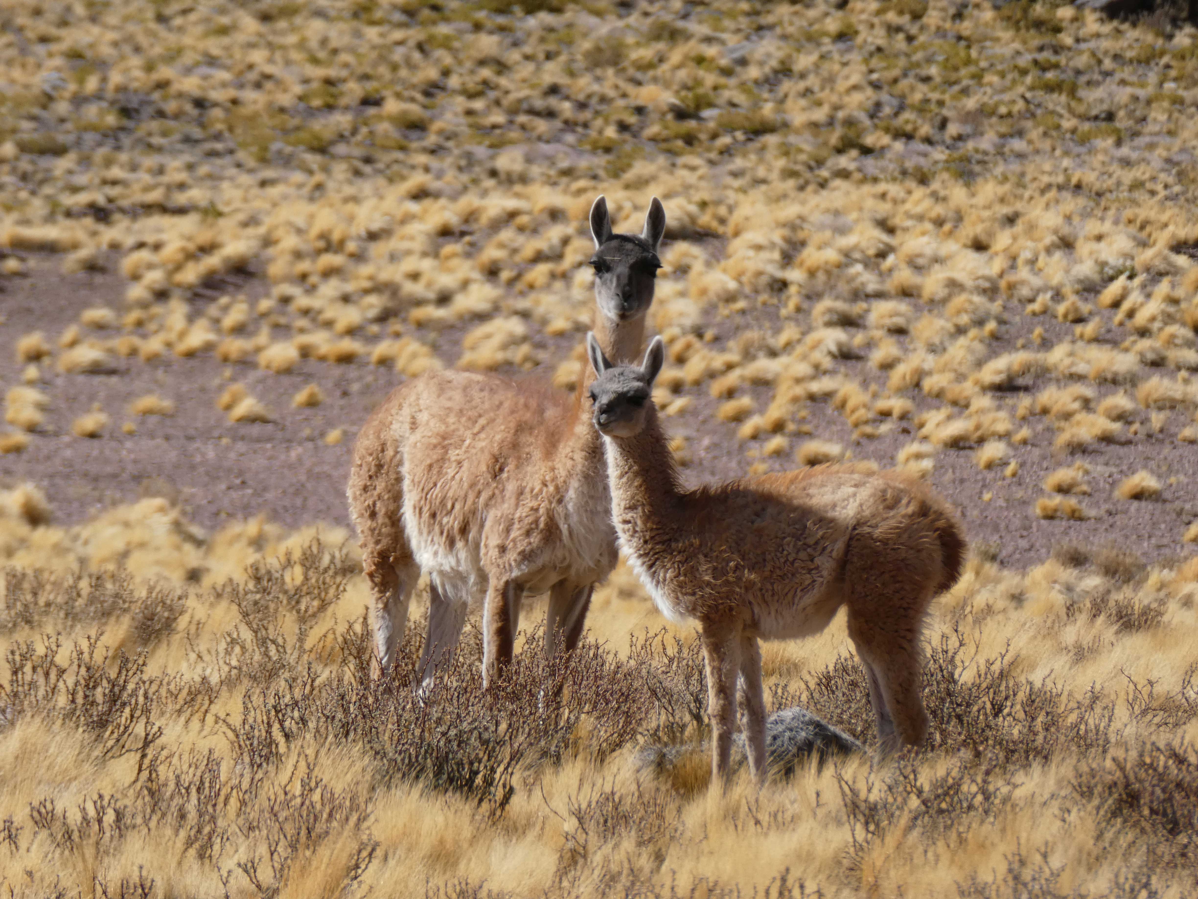
Of course, where there’s rhea, you’ll also find camelids roaming the landscape. The Chilean version is the vicuña. Vicuña are smaller than guanacos and llamas and arguably cuter with their large dark eyelashes and sleek physiques. Here’s a mom and baby that were unusually close to the car as well.
To visit the salar and lagunas, you must have a reservation or they will turn you away after making the drive. Chile does not make it easy for tourists to actually figure out how to pay fees and visit sights, but between the Rough Guide and help from the staff at Don Tomas, we managed to figure it out. The government provides a lovely website in English that supposedly lets you make a reservation and pay the park entry fees. In reality, as with other websites in Chile, the Chilean banking system pretended to start processing our credit cards and then eventually failed to make the transaction. We tried several times with several cards before consulting the staff at Don Tomas. They ended up placing a call and making a reservation for us so that we could pay at the park entrance.
With our reservation, we had to stop at the town of Sociare about an hour into the drive, which serves as the entrance to the local attractions and where you get your tickets. It is a tiny town with no signage. We parked at a likely looking building near locals selling souvenirs in the center of town and actually found the ticket office. After a lengthy conversation in broken Spanish, we had our tickets and assumed we knew where we were going. We immediately headed the wrong way, turned off onto a barely passable dirt road, and drove until we felt the car could go no farther and convinced ourselves this couldn’t be the main route to a major tourist attraction. We turned around and returned to the ticket office. The clerk actually came outside and pointed back along the highway so we could find our way. We had another hour or so of driving along the same highway we came in on.
Solar de Aguas Caliente
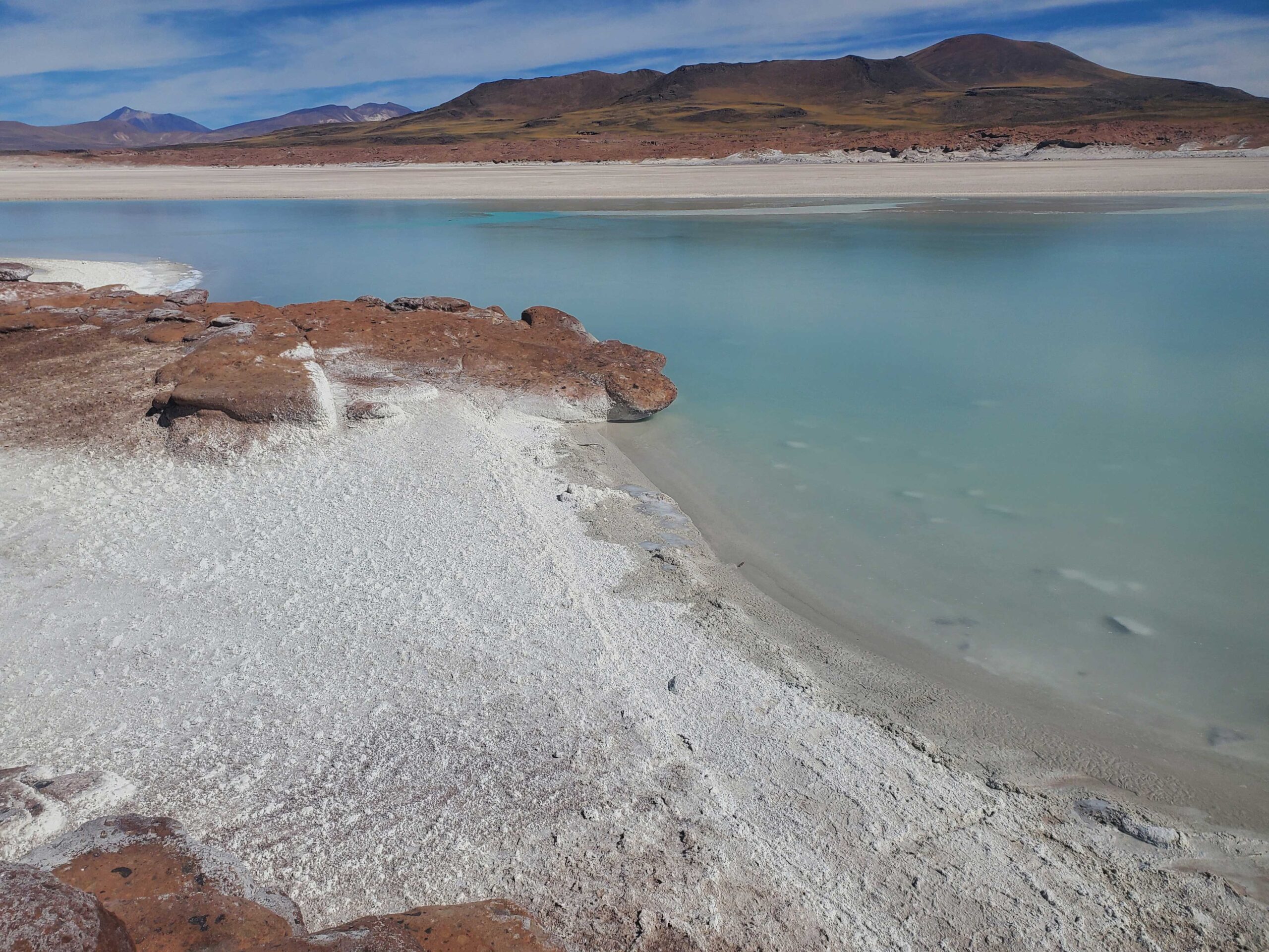
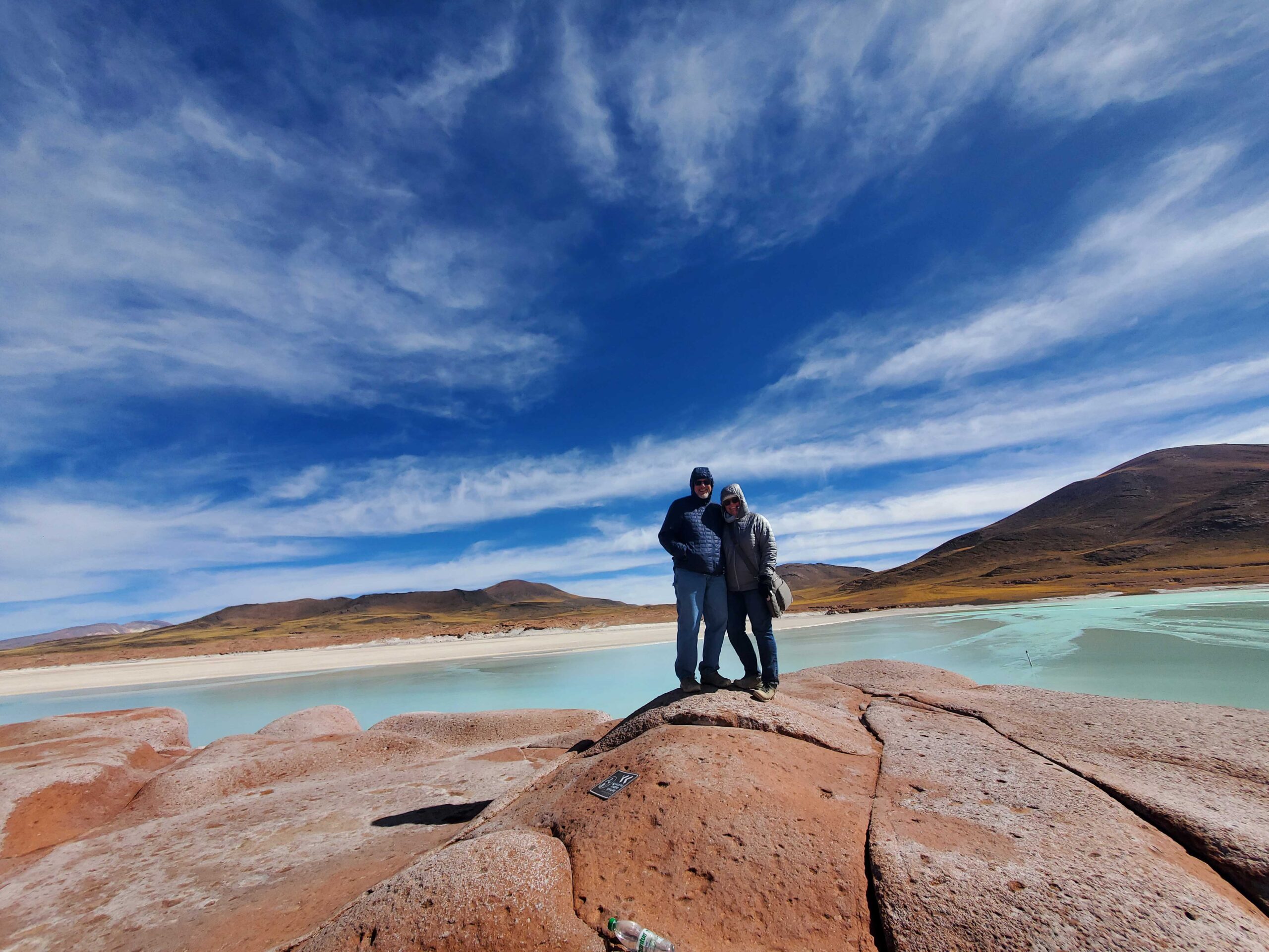
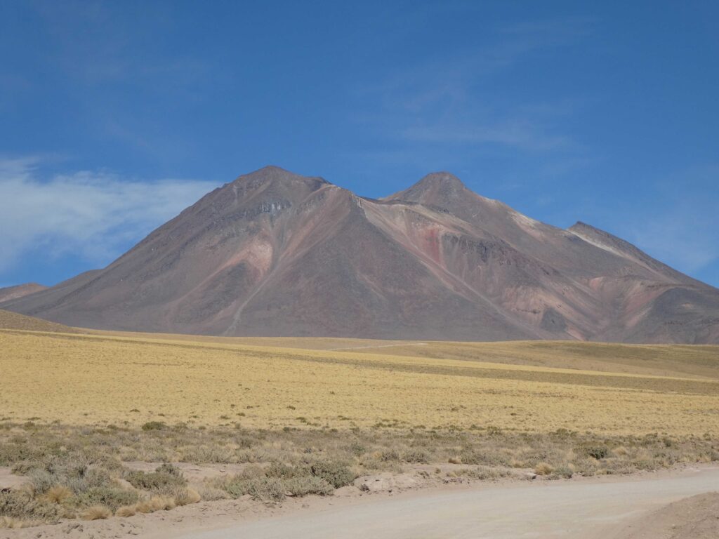
Our trials at securing entrance and finding Salar de Aguas Calientes were well worth the effort. Here’s a view across the water to one of the many volcanoes that dot the landscape. We honestly have no idea which one this is.

What you may immediately notice is that the “aguas calientes” look frozen. It is 14,000 feet, windy, and cold. The surface of the water is most definitely frozen. This selfie may give you some idea of how cold it actually was in the high desert.

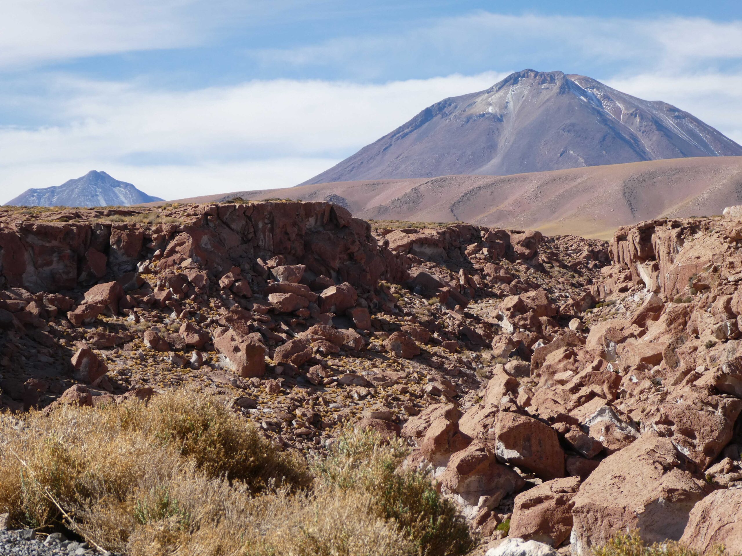
You can see the white shores along the edges of the water. These are the beginnings of the salt flats. What stood out most about this area was the variety of landscape surrounding the water. There was no homogeneity as there was in Valle de la Luna. Look in one direction from one vantage point, and you have deep red jagged surfaces mixed with the dusty white salt plains.

Walk around the lake a little further and you are now on the frozen lava bed of an ancient eruption traversing the porous volcanic surface with the salt flats and yellow grass covered plains butting up against the foothills.

Travel around a little further along, you come to what looks like a totally flat poured concrete field with expansion joints separating the sections. Of course, there’s an impressive volcano in the background.

It is a salar, and the main feature is the salt flats. There were plenty of salt flats to compete with and complement the varied volcanic landscape.
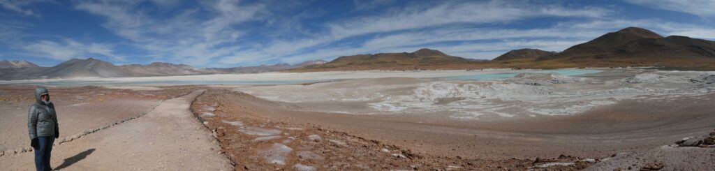

All aspects of the scenery were competing with each other for dominance between the crusty white salt, yellow plains, red rocks, and aqua blue waters. We like this shot because the sky adds another layer to the mix.
Los Lagunas
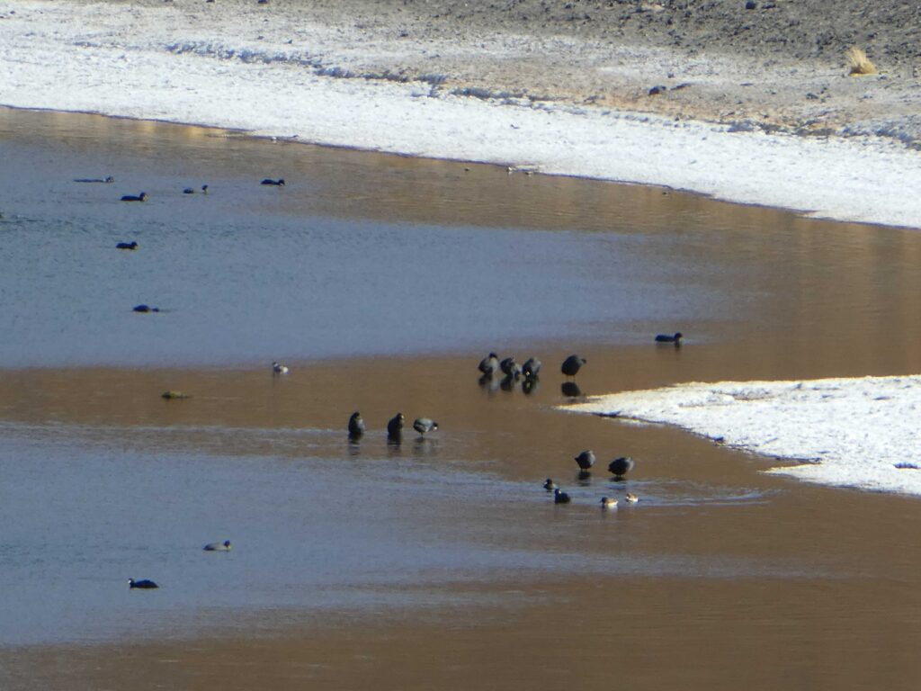
One obvious feature missing from our exploration of the salar was any sign of wildlife other than human. The combination of the incongruously frozen thermal waters and high salt content isn’t very hospitable for birds and the like. To hopefully get a view of some wildlife (there were rumors of flamingos), we had to next head to the two lakes in the area.
The drive between the salar and the lagunas was beautiful and presented another view of the high desert landscape. Before we get to the waters, here are some of the sights we enjoyed along the road as we drove. The views really show the contrast between the red soils and the yellow clumps of grass backed by smooth hills that typified the area.
Our first laguna stop was the surprisingly perfectly shaped Laguna Miscanti with the backdrop of what we believe to be Volcan Miscanti in the background. Unfortunately, we didn’t find flamingos there or any real sign of water fowl. The only life along the lake were some vicuña on the far side. However, the sight of the lake and the volcanoes did not disappoint.


After a short drive, we came to Laguna Miñiques that had a similar landscape but a lot more water fowl. You’ll notice the white salty shoreline here as well. We spent our time trying to photograph the ducks but only got a bunch of duck butt shots. Here’s one of the better duck pictures to close out this post.
Still reading all of your posts. Really enjoy the pictures. Love you stay safe.